The first satellite in the Indian Regional Navigation Satellite System, IRNSS-R1A, was launched at 1811 GMT on 1 July from the Sriharikota launch site in India using the PSLV-XL (PSOM-XL) launch vehicle. The 1425kg IRNSSI-R1A is the first of seven satellites in the series. The spacecraft uses the I-1K (I-1000) developed by the Indian Space Research Organisation (ISRO). The satellite transmits L-band navitation signals to users. The spacecraft is to be place into a 24 hour period geosyncronous Earth orbit located at 56 degrees East longitude and with a 29 degree inclination.
India launches its own navigation satellite IRNSS-R1A successfully
About Seradata
Seradata produces the renowned Seradata database. Trusted by over 100 of the world’s leading Space organisations, Seradata is a fully queryable database used for market analysis, failure/risk assessment, spectrum analysis and space situational awareness (SSA).
For more information go to https://www.seradata.com/product/
Related Articles
The following construction and launch orders for the space industry were announced in June 2025: Construction Orders: Despite a regulatory Read more
!function(){"use strict";window.addEventListener("message",function(a){if(void 0!==a.data["datawrapper-height"]){var e=document.querySelectorAll("iframe");for(var t in a.data["datawrapper-height"])for(var r,i=0;r=e[i];i++)if(r.contentWindow===a.source){var d=a.data["datawrapper-height"][t]+"px";r.style.height=d}}})}(); !function(){"use strict";window.addEventListener("message",function(a){if(void 0!==a.data["datawrapper-height"]){var e=document.querySelectorAll("iframe");for(var t in a.data["datawrapper-height"])for(var r,i=0;r=e[i];i++)if(r.contentWindow===a.source){var d=a.data["datawrapper-height"][t]+"px";r.style.height=d}}})}();

A test stand at SpaceX’s Starbase facility was severely damaged in an explosion, marking a potentially major setback to the Read more
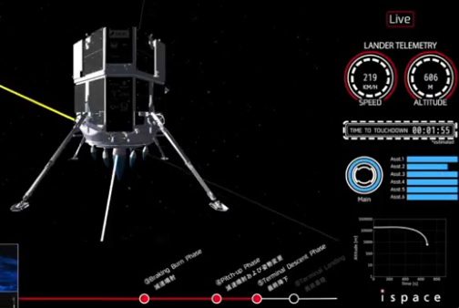
A Japanese lunar lander crashed on the Moon after it failed to sufficiently slow its descent. Hakuto-R M2’s collision, at Read more
!function(){"use strict";window.addEventListener("message",(function(a){if(void 0!==a.data["datawrapper-height"]){var e=document.querySelectorAll("iframe");for(var t in a.data["datawrapper-height"])for(var r=0;r
The following construction and launch orders for the space industry were announced in May 2025: Construction Orders: Chinese satellite developer Read more

We are cutting through the orbital debris for you. In other words, we're keeping an eye on space news on Read more
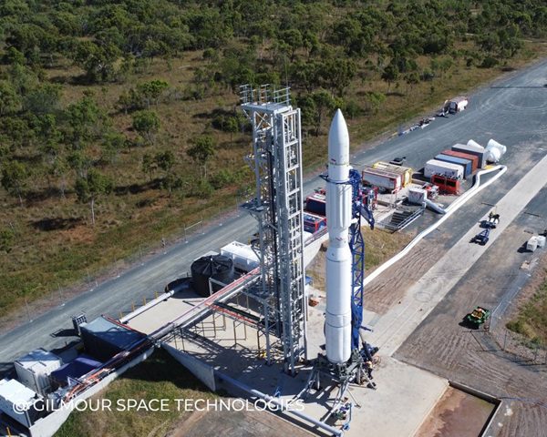
Australia’s Eris Block 1 rocket, made by Gilmour Space Technologies, had a rough start to its career with a pre-launch Read more
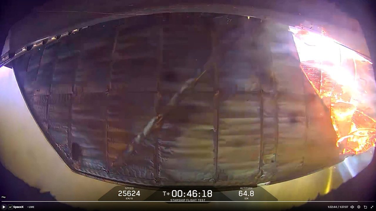
SpaceX has suffered another Integrated Flight Test failure and lost both Starship and its Super Heavy booster. The IFT-9 test Read more
Stay Informed with Seradata
Stay informed on the latest news, insights, and more from Seradata by signing up for our newsletter.